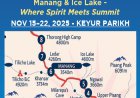

Ghyaru Heights & Manang Nights — Annapurna Circuit Day 2

Day 2 — Chame → Lower Pisang (Jeep), Trek to Ghyaru, Overnight in Manang
Annapurna Circuit • Nov 16
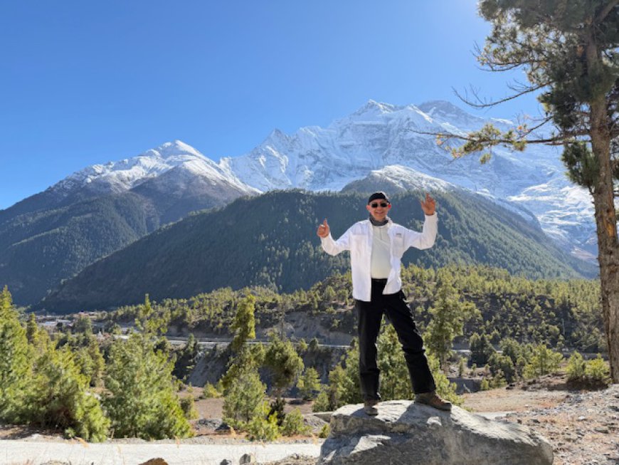
We left Chame (2,670 m / 8,760 ft) by jeep early this morning and drove up the valley to Lower Pisang (~3,300 m / 10,830 ft). From here, we began one of the Annapurna Circuit’s most rewarding stretches—the famed high-trail climb to Ghyaru (≈3,670 m / 12,040 ft).
The High Trail to Ghyaru
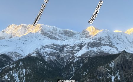
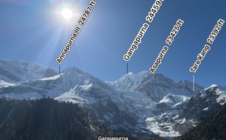
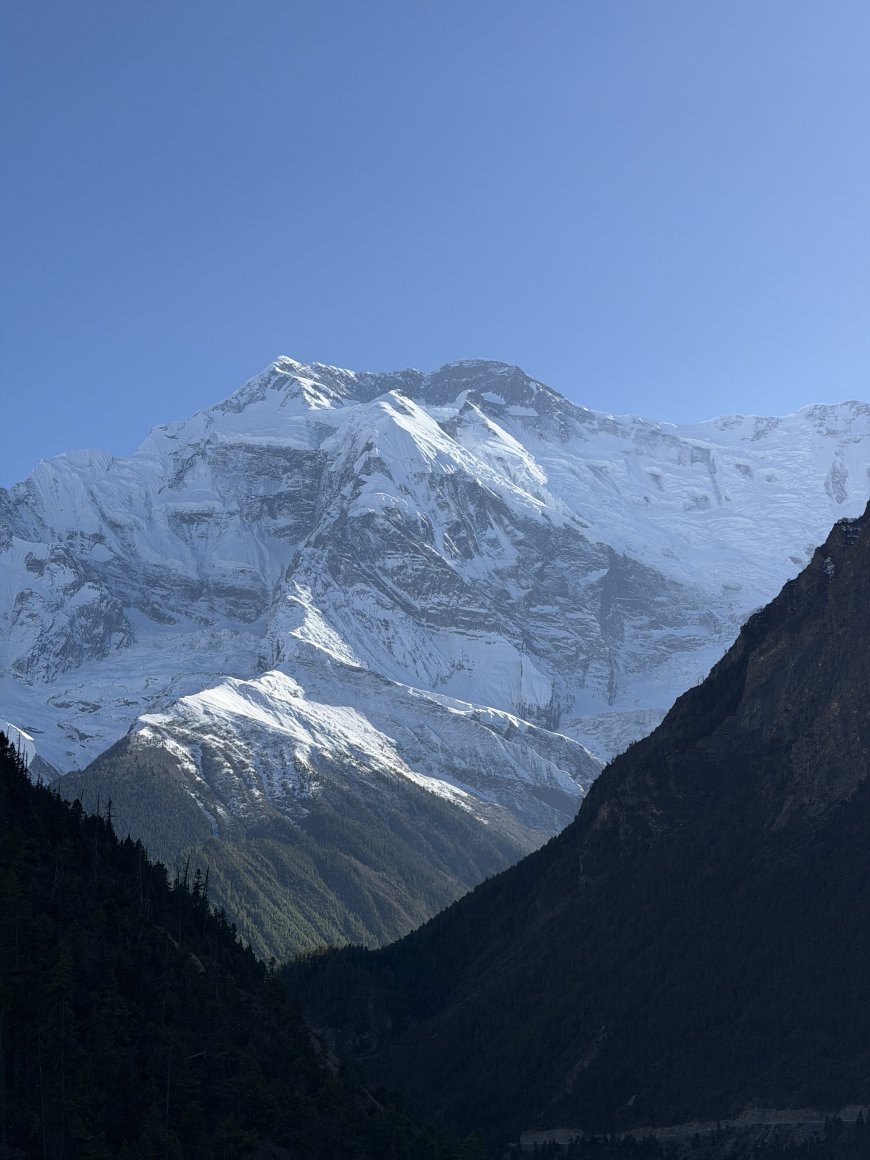
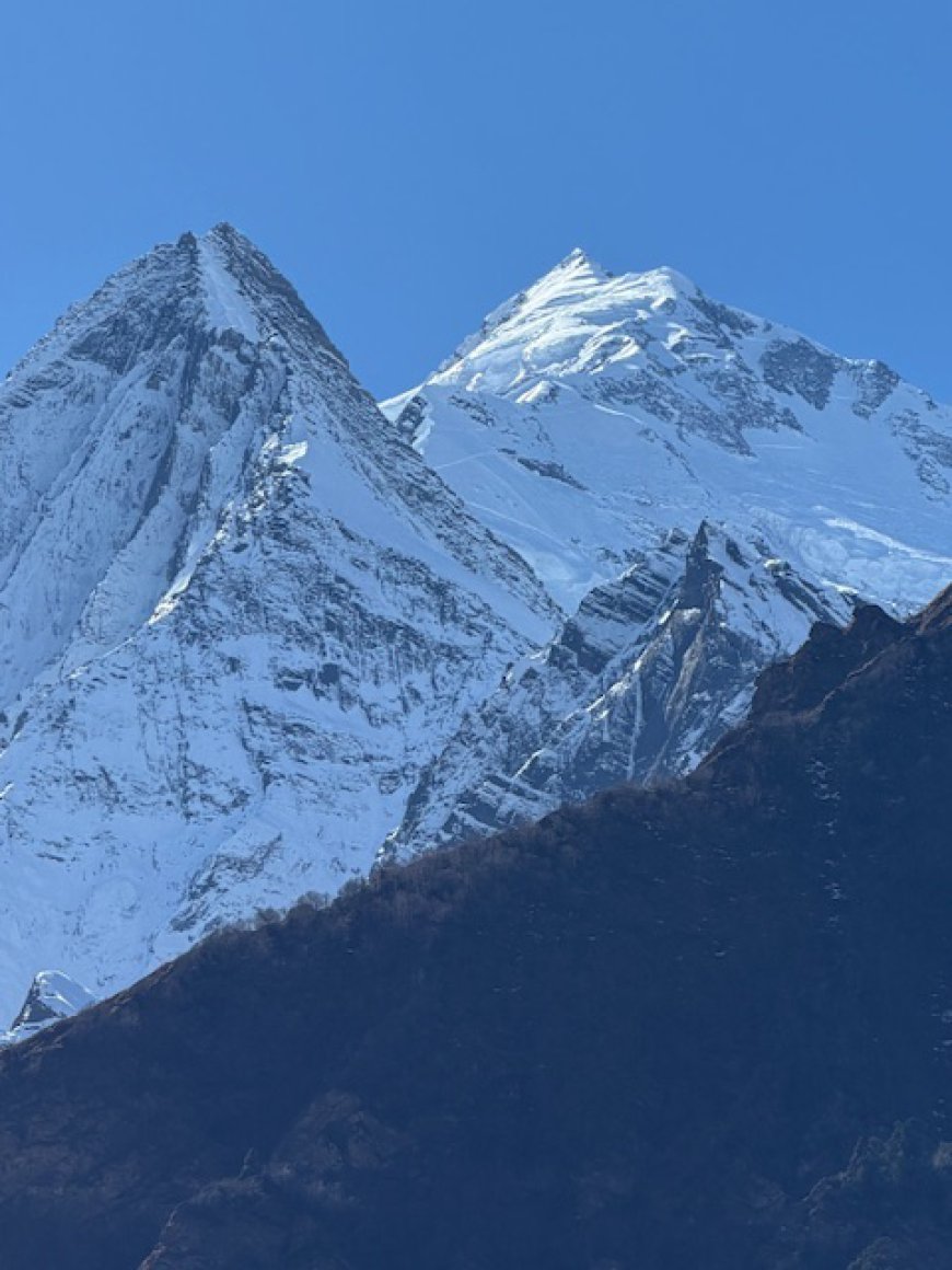
The ascent follows classic stone switchbacks, gaining 350–400 m above the Pisang valley. With every step upward, the horizon opens into a dramatic Himalayan panorama:
-
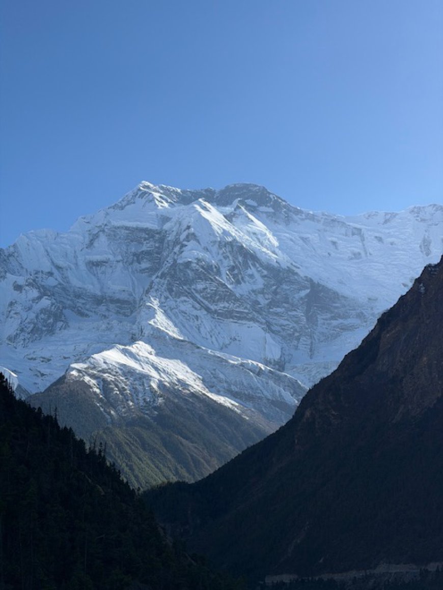
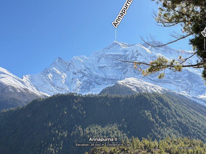
Annapurna II & III — immense walls of ice and rock
-
Gangapurna — sweeping ridgelines and a glacier cutting the skyline
-
Pisang Peak — a perfect triangular summit above the valley
-
The Marshyangdi River tracing a wide, silver arc far below
This viewpoint is the essence of the high route—clear, crisp air, huge landscapes, and a balcony-like vantage over the Annapurna giants.
WOW Factor: 9.5 / 10 — this is exactly why trekkers choose the high trail.
Manang — The Crown Jewel of the Circuit
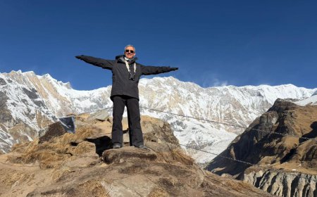
After enjoying the views from Ghyaru, we descended to rendezvous with our vehicle and continued up-valley to Manang (3,540 m / 11,620 ft) for the night.
Manang sits in a naturally sculpted amphitheater surrounded by 6,000–8,000 m peaks. It serves as the acclimatization capital of the Annapurna Circuit—an ideal base before major objectives like Thorong La (5,416 m) and, for us, before our Ice Lake ascent.
We checked in at Mountain Lodges of Nepal, an excellent stay and easily one of the best accommodation options on the entire circuit.
Health & Pacing
-
Maintained a steady, aerobic trekking rhythm with short recovery stops on steep sections
-
Hydration: ~3–3.5 L through the day + warm soups & tea
-
Strong sun and snow glare: sunscreen + sunglasses essential
-
Evening: light dinner, gear dry-out, early rest for tomorrow’s acclimatization hike
Route Recap
-
Start: Chame → Lower Pisang (jeep)
-
Trek: Lower Pisang ↑ Ghyaru (3,670 m) → descend to pickup point
-
Finish: Drive to Manang (3,540 m) → lodge check-in
By the Numbers (5:18 pm)
-
Steps: 18,523
-
Distance: 13.2 km
-
Max altitude: 3,670 m (12,040 ft) at Ghyaru
-
Elevation gain: approx. +350–400 m
Tomorrow
We continue along the high route toward Ngawal (≈3,660 m / 12,010 ft) for more ridge-top views and a measured acclimatization day.
What's Your Reaction?
 Like
0
Like
0
 Dislike
0
Dislike
0
 Love
0
Love
0
 Funny
0
Funny
0
 Angry
0
Angry
0
 Sad
0
Sad
0
 Wow
0
Wow
0